

The Real-Time Hail product provides a geographical description of hail events, detailing the effects of a storm on a specific location. Most “after-the-fact” hail impact products employ algorithms to analyze digital radar data and plot the “best path” of the event but Roof Alert is different.
ROOF ALERT IS PROUD TO OFFER THE LATEST UPGRADE TO HAIL MAPS,
REAL-TIME HAIL.
Real-Time Hail is a product that provides a geographical depiction of areas that were affected by hail, during a specific storm and place. Most after-the-fact hail impact products employ algorithms to analyze digital radar data and plot “the best path” of a hail impact area.
Real-Time Hail provides the full extent of a hail impact area on a Google Earth map, uses real-time meteorologists to manually analyze the specific radar data in accordance with guidelines and analysis techniques from Federal and National Weather Service agencies, and provides a narrative of events centered on the specific hail storm.

With other algorithm-derived products, hail occurrence is listed in ranges from a site-specific property, such as “within 1 mile”, or “within 3 miles” or “within 10 miles”. This wide variance of ranges doesn’t allow a user to determine whether or not a site-specific address was affected. Did the hail fall within 3 miles? If so what direction?
With Real-Time Hail, you will receive a real-time map of the atmospheric conditions and the area affected by hail; manually analyzed by meteorologists that have received Federal certification in the analysis and interpretation of weather radar imagery; not something spit out by an algorithm.
The weather radar used for Real-Time Hail is called NEXRAD; a Doppler weather radar, employed by the National Weather Service and is the standard for radar analysis and interpretation.
All the meteorologists for Roof Alert have received the requisite training, testing and certification, similar to what meteorologists in the NWS and Department of Defense must achieve.

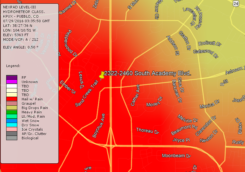
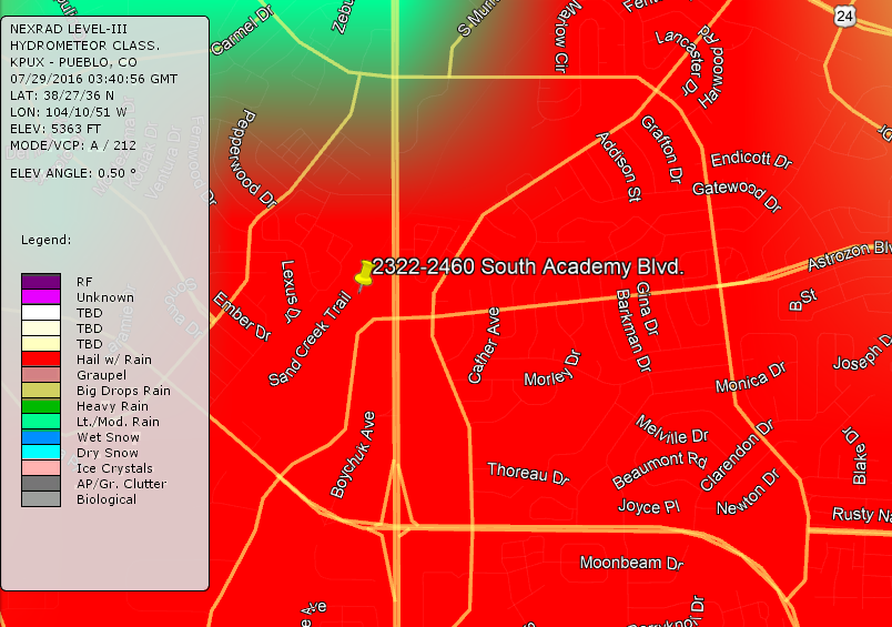
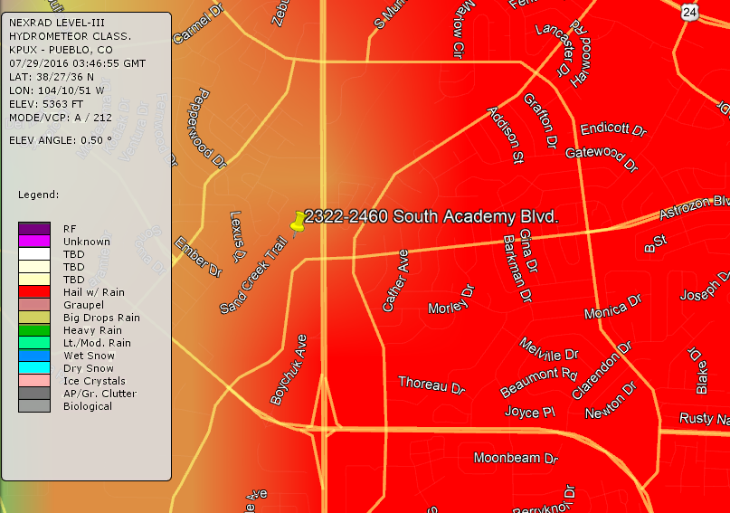
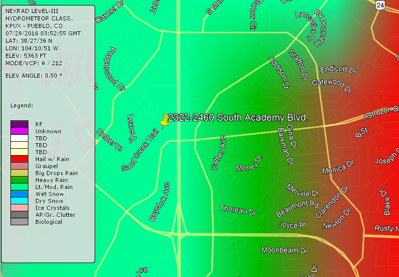
In the example above, you see a weather radar product titled Hydrometeor classification, and the Red area represents “Hail with rain”. This image provides you with exact street names and the extent of the area affected by hail.
